 |
| An approximate topo of Wham Ridge on Vestal Peak Blue= standard version (5.4); Green="Center Shift" (5.6) |
| Molas Pass Trailhead Length: 19 miles Difficulty: II 5.4 (III 5.6 for "Center Shift") Elevation gain: 7,000 feet Exposure: Moderate/high | Elk Park Trailhead Length: 12 miles Difficulty: II 5.4 (III 5.6 for "Center Shift") Elevation gain: 5,200 feet Exposure: Moderate/high |
OVERVIEW
 |
| Vestal Peak towers above Vestal Basin |
Wham is a popular route for a technical alpine climb. It's moderate difficulty and ultra-aesthetic setting have made it one of the premier destinations for a first technical route for aspiring mountaineers. While it has a reputation of being easy, there are a few hazards that are worth mentioning that make any attempt at Wham become more than you bargained for.
First, Wham consists of quartzite. While it makes for some of the most solid rock in the entire range, it is akin to lubricated glass when it is wet. This stuff is slick. Play around on it even at camp after storm and you will see what I mean. This is no place to be in a storm.
Second, the descent is long and complicated. While it is only rated class 2+, it is long, loose and steep. It is easy to get sucked into class 3 terrain. Many people, too, have tried to descend directly south from the summit, only to find themselves pulled into even steeper and looser class 4.
Third, the San Juans are notorious for violent, long-lived storms. Their position on the western edge of the Rocky Mountains means that they are the first mountains to receive any weather systems blowing in with the trade winds. San Juan ski areas like Wolf Creek and Purgatory (Durango Mountain Resort) get some of the most snow in the state. The San Juans in turn get some of the most rain and some of the most violent weather of all the ranges in Colorado.
All of this being said, this one amazing part of the state, and any journey in is bound to be both challenging and rewarding. Wham Ridge of Vestal Peak is certainly worthy of its designation as a classic, and worth any trip for the mountaineer who is experienced and adventurous enough for the challenge.
THE ROUTE
 |
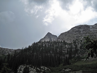
| The Grenadiers from the Molas Trailhead |
Cross the tracks and find a good trail that starts to gently climb up the slopes on the east side of the river. After about half a mile, you join Elk Creek trail and come to a kiosk and register. It is a good idea, always, to take the moment to fill out the register. if you took the train in and got off at Elk Park, you will have walked an easy half mile to get to this point.
The next portion of the trail climbs a little under 1,000 feet in about two and half miles to a beautiful and obvious Beaver Pond at 9,900 feet. Arrow and Vestal can be seen up the basin from here to the south and there is good camping in the area of the beaver pond. On our last trip, we saw a moose here at the Beaver Pond.
The next section of the route is a bit arduous, especially if you are carrying a heavy backpack....
 |
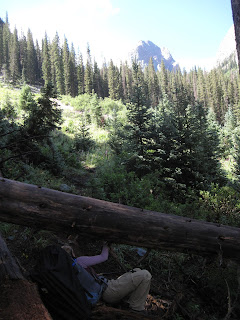
| Ducking under logs on the way to Vestal Basin |
Cross the creek and start up what we dubbed "Hell Hill." The hill itself is only about 2 miles and gains just over 1,500 feet in elevation, but the trail is littered with downed trees and potential wrong turns. Stay high and stick to the main trail. Trying to stay closer to the creek will result only in rougher and steeper terrain you will have to negotiate.
At last you make it to the meadow at 11,500 feet in Vestal Basin. There are a couple of good campsites in the area, the best probably being on the left (east) side of the trail almost directly across from Wham itself. The mountains are beautiful and dramatic from this basin.
Climb up a steepening talus slope to the right of the obvious waterfall at the end of the meadow, and make your way to the bottom left corner of Wham Ridge (actually the peak's entire north face). Scramble up to a grassy ledge and do a rising traverse up and right to the face's west side just over 12,500 feet. So far the terrain shouldn't have exceeded class 3.
Scramble up the steepening face along its right side, roping up when and if you start feeling uncomfortable. There are a couple of decent splitter crack systems you can follow. The angle and difficulty steepen to low class 5 but just when it seems things are going to get really good, the rock becomes fractured and the climbing broken. Most people de-rope here and scramble the last few hundred feet on gunky class 4 to 5.easy to the summit.
 |
| Having fun with Wham |
The descent is considered class 2+ but many people consider in class 3. It is long, loose and steep and not a great route to be on in a storm. From the summit descend southeast (not directly south, this leads to steep class 4 terrain) into a gully system on loose rock. Traverse when possible, following cairns for guidance, across the peak's south face, ultimately reaching the saddle between Vestal and Arrow Peaks. All that stand between you and the meadow is a gnarly downclimb down the slope Gerry Roach calls "Dues Collector" in his guidebook Colorado's Thirteeners: 13,800 to 13,999 feet. Back at the meadow you can relax (unless you have a train to catch) and be proud: you have just climbed one of Colorado's most aesthetic and classic mountaineering lines.
DIRECTIONS
The trailhead is found two miles north of Molas Pass on Highway 550 and five miles south of the town of Silverton. It is found in-between the turn offs for Molas and Little Molas Lake Campgrounds. The trailhead is a large dirt parking lot just off the highway on the canyon/mountain side.
TRIP REPORTS
Dirty (Wet) 30: or Five Rainy Days in the San Juans
Our attempt at Vestal and Arrow runs afoul of rain storms, bad navigation, and a general lack of time, but the trip was still one to remember.
LINKS
Mountainproject.com- Page on Wham Ridge standard route.
Summitpost.org- An information page on Wham Ridge (standard) route.
Visit THE ARCHIVE: A list of most of our articles sorted by department

No comments:
Post a Comment