length: 9 miles
difficulty: class 1+
elevation gain: 4,400'
special beta: busy on a summer weekend
INTRO
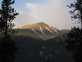
The Northeast ridge is one of two "standard" routes up Mount Elbert and the easiest way to climb Elbert from the north. There is a decent trail all the way to the summit. Though the route is easy from a technical standpoint, it is just over nine miles in length round-trip and gains almost 4,500' of elevation. This can be a strenuous climb for those who take it on too lightly. The reward for the long hike, however, is the second highest perch in the lower 48 behind only California's Mt. Whitney.
From Highway 24 approximately 3 miles south of Leadville, turn west onto Highway 300. After .8 mile turn left (south) on CR-11. 1.2 miles farther, follow signs toward Halfmoon Creek and turn right. The North Mt. Elbert TH is five miles farther on the left (south) side of the road. There are several National Forest campsites in the area as well as dispersed camping. The more environmentally correct option is to stay in the developed, fee-based areas. If you must set-up in dispersed areas, please avoid building fire rings, there are plenty already. The North Elbert trailhead is about one half-mile east of the Mt. Massive trailhead (which is on the opposite side of the road).
ROUTE DESCRIPTION
 From the trailhead at just over 10,000', follow the North Mt. Elbert Trail as winds through a pristine forest on Elbert's northeast flank. Leave the Colorado Trail behind at mile 1.4 and turn right towards Mt. Elbert. This junction is at about 10,400'. This may be a good place for a short rest as the route becomes much steeper from here. Around mile 2.7 you reach treeline, and the upper portion of the mountain comes into view (note: you cannot see the actual summit yet). From this point you have about two miles of hiking left but you still must climb over 2,500' of elevation to reach the top.
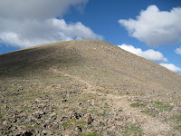
Once past treeline, the trail begins to switchback steeply up Mt. Elbert's barren northeast ridge. Though the trail is quite good, you may still have to pay close attention to your footing on the steepest sections, especially if you aren't used to hiking on scree at altitude. In terms of difficulty of terrain, this route is slightly harder than the Grays Peak trail but not as hard as the South Slopes standard route up Torreys.
When you reach what has thus far appeared to be the top, you will find that it is only a false summit and the actual top is still a little farther. Depending on what kind of day you are having this may or may not be discouraging. If you're feeling exhausted, take heart knowing that Colorado's highest point is just under a half mile and four-hundred vertical feet away.
On Mt. Elbert's summit you will most likely be joined by hikers who have climbed Elbert from other routes, such as the popular South Mt. Elbert Trail. No matter, this commodious summit has something for everyone. To the north you can look out across the Halfmoon Creek area at Mt. Massive and revel at the might of its girth and lofty summits. Also visible to the north and west are centennial thirteeners Mt. Oklahoma (13,845'), French Mountain (13,940'), Casco Peak (13,908'), and "Lackawanna Peak" (13,823'). The view to the south is dominated by the familiar shapes and humps of other Sawatch fourteeners, especially La Plata (14,336') whose dramatic north face and rugged Ellingwood Ridge are particularly astounding from the vantage atop Elbert. The surrounding mountains are so impressive, in fact, that we once met a man on Elbert's summit who was convinced (and pissed off) that he'd climbed the wrong mountain because others nearby appeared taller. We tried to assure him that distance and perspective can be deceiving and that he was indeed on the highest mountain in the American Rockies.
Visit THE ARCHIVE: A list of most of our articles sorted by department


No comments:
Post a Comment